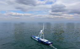
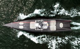
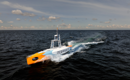
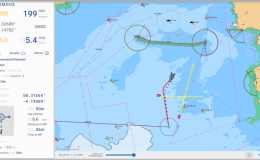
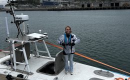
Autonomous Surface Vessels (ASVs), also known as Uncrewed Surface Vessels (USVs), are transforming maritime operations by allowing vessels to travel, monitor and perform missions without anyone onboard. From scientific research and offshore energy inspections to defence, hydrographic surveying and environmental monitoring, autonomous vessels are rapidly becoming an essential part of the modern maritime industry.
A question often asked by organisations considering autonomous technology is simple: how can a vessel safely navigate without a captain or crew?
The answer lies in the combination of advanced sensors, artificial intelligence (AI), satellite positioning, sophisticated software and continuous situational awareness. Modern autonomous vessels do far more than simply follow a pre-programmed route. They constantly interpret their surroundings, identify hazards, predict the movement of other vessels and make safe navigational decisions in real time.
This article explains how autonomous surface vessels navigate without a crew and why autonomous navigation is becoming one of the most significant advances in maritime technology.
If you’re new to autonomous maritime technology, you may also find our guide What Is an Autonomous Surface Vessel? useful, which explains the different types of ASVs, their applications and why they are becoming increasingly important across defence, offshore energy and marine science.
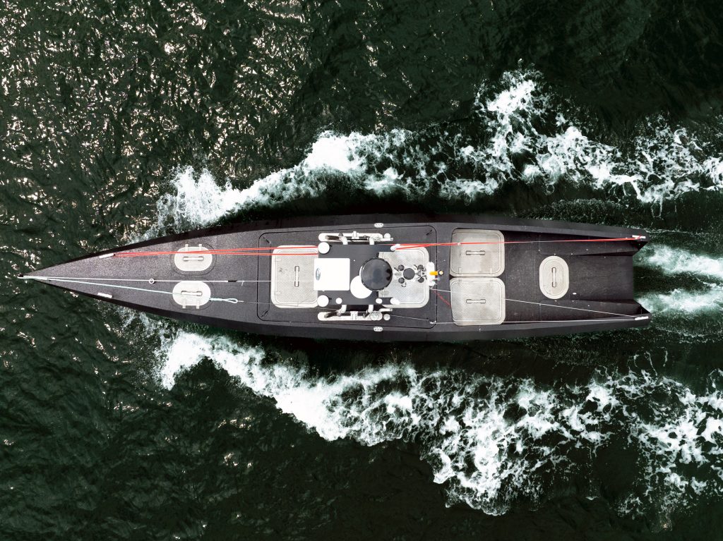
What Is an Autonomous Surface Vessel?
An Autonomous Surface Vessel is a watercraft capable of operating with minimal or no human intervention. Depending on the mission, an ASV may operate:
- Fully autonomously
- Under remote supervision
- With a hybrid combination of autonomy and human oversight
Unlike conventional vessels, there is no bridge crew making continual navigational decisions. Instead, onboard systems perform many of the tasks traditionally undertaken by experienced mariners.
The level of autonomy varies according to mission requirements, regulatory constraints and operational environments.
The Five Pillars of Autonomous Navigation
Safe autonomous navigation relies on five integrated capabilities:
- Position awareness
- Environmental perception
- Intelligent decision making
- Vessel control
- Continuous communication
Together these systems create a constantly updated understanding of the surrounding environment that enables the vessel to operate safely.
1. Knowing Exactly Where the Vessel Is
Every autonomous mission begins with precise positioning.
ASVs use multiple navigation technologies simultaneously, including:
- Multi-constellation GPS
- GNSS (Global Navigation Satellite Systems)
- Differential GPS corrections
- Inertial Navigation Systems (INS)
- Electronic compasses
- Gyroscopes
- Motion reference units
Rather than relying on a single GPS signal, autonomous vessels combine information from several positioning systems. This sensor fusion significantly improves accuracy and provides resilience should one positioning source become unavailable.
The vessel continually compares its planned route with its actual position, often updating several times every second.
2. Seeing the World Without Human Eyes
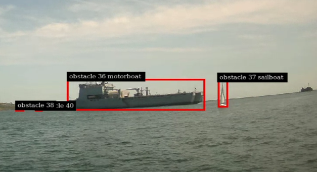
Perhaps the greatest challenge for autonomous vessels is replacing human vision.
Instead of relying on a bridge crew looking through windows, ASVs build a digital picture of their surroundings using multiple sensors.
These typically include:
Marine Radar
Radar detects:
- Other vessels
- Coastlines
- Buoys
- Harbour structures
- Floating objects
Radar works day and night and remains effective during fog, rain and poor visibility.
Electro-Optical Cameras
High-resolution daylight cameras provide visual confirmation of surrounding objects.
AI software analyses the video feed to identify:
- Ships
- Fishing vessels
- Navigation markers
- Small craft
- Debris
- Wildlife
Computer vision algorithms perform many of the same recognition tasks as a human lookout.
Thermal Cameras
Infrared imaging enables detection during:
- Darkness
- Heavy rain
- Mist
- Low visibility
Thermal sensors are particularly valuable for identifying vessels or people in the water at night.
LiDAR
Many advanced autonomous vessels also use LiDAR.
LiDAR sends thousands of laser pulses every second to create a detailed three-dimensional model of nearby objects.
This allows precise measurement of:
- Distance
- Object size
- Relative movement
- Harbour infrastructure
- Docking areas
LiDAR is especially useful during close manoeuvring.
Automatic Identification System (AIS)
Commercial vessels transmit AIS information including:
- Position
- Speed
- Course
- Vessel identity
- Destination
Autonomous systems combine AIS information with radar and cameras to improve awareness of surrounding traffic.
3. Sensor Fusion: Building One Complete Picture
No single sensor is perfect.
GPS can lose accuracy.
Radar cannot always distinguish object types.
Cameras may struggle in fog.
AIS only works if other vessels are transmitting.
Instead of depending on one technology, autonomous navigation platforms combine data from all sensors into one integrated situational awareness model.
This process is known as sensor fusion.
Artificial intelligence continuously compares information from every available sensor to produce the most accurate understanding of the surrounding environment.
If one sensor becomes unreliable, others continue providing essential navigation information.
This redundancy is one of the key reasons autonomous vessels can operate safely in challenging maritime environments.
4. Artificial Intelligence Makes Navigation Decisions
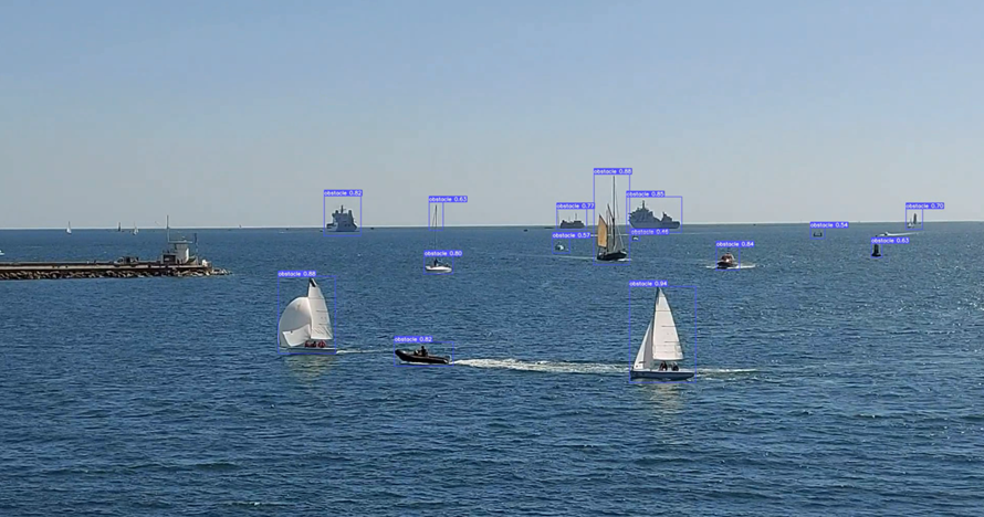
Collecting sensor data is only the beginning.
The real intelligence comes from interpreting that information.
AI software continuously evaluates:
- Vessel traffic
- Collision risks
- Weather conditions
- Sea state
- Water depth
- Mission priorities
- Navigation rules
Unlike simple waypoint navigation systems, autonomous vessels predict how situations are likely to develop over the coming minutes.
For example:
If another vessel appears on a crossing course, the AI estimates:
- Current speed
- Heading
- Future position
- Closest point of approach
- Collision probability
It can then decide whether to:
- Alter course
- Reduce speed
- Maintain course
- Wait for another vessel to pass
These calculations occur continuously throughout the mission.
5. Following International Collision Regulations
One of the greatest challenges in maritime autonomy is complying with the International Regulations for Preventing Collisions at Sea (COLREGs).
These internationally recognised rules govern how vessels interact.
Examples include:
- Head-on encounters
- Crossing situations
- Overtaking manoeuvres
- Safe passing distances
- Navigation in narrow channels
Autonomous navigation software is specifically designed to apply COLREGs when making navigation decisions.
Rather than simply avoiding obstacles, modern autonomy systems make decisions consistent with accepted maritime practice.
This improves predictability for nearby crewed vessels.
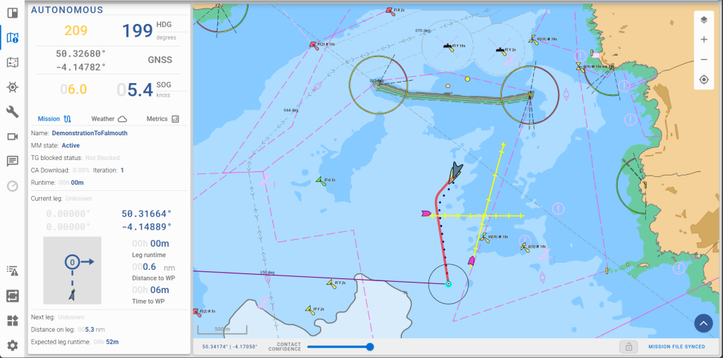
Dynamic Route Planning
Traditional autopilots simply follow a fixed course.
Autonomous vessels continuously update their route.
If conditions change, the vessel can automatically:
- Navigate around obstacles
- Avoid congested shipping lanes
- Compensate for tidal drift
- React to weather changes
- Optimise fuel or battery efficiency
This adaptive route planning makes autonomous operations significantly more efficient than static navigation.
Controlling the Vessel
Once a navigation decision has been made, the onboard control systems translate that decision into physical movement.
The autonomy platform controls:
- Rudders
- Thrusters
- Electric propulsion
- Engines
- Dynamic positioning systems
These systems constantly adjust heading, speed and steering to maintain the safest and most efficient course.
Many corrections are so small they occur almost continuously.
Remote Supervision Adds Another Layer of Safety
Despite the term “autonomous”, many commercial operations still involve remote human oversight.
Operators located in shore-based control centres can:
- Monitor multiple vessels simultaneously
- Review live sensor feeds
- Receive alerts
- Approve mission changes
- Assume manual control if required
This human-in-the-loop approach combines the efficiency of autonomous navigation with experienced operator oversight where necessary.
Navigation During Challenging Conditions
Marine environments are constantly changing.
Autonomous systems must cope with:
- Heavy seas
- Strong currents
- High winds
- Poor visibility
- Busy ports
- Floating debris
- Variable weather
Machine learning enables navigation software to improve its performance over time as it encounters increasingly diverse operating conditions.
Combined with redundant sensors, this allows many autonomous vessels to continue operating safely even when individual systems experience degraded performance.
Cyber Security and System Resilience
Because autonomous vessels depend on digital systems, cyber resilience is an essential part of navigation.
Modern autonomy platforms incorporate multiple layers of protection including:
- Encrypted communications
- Secure software architecture
- Redundant computing systems
- Backup navigation sensors
- Continuous health monitoring
If one system fails, backup systems maintain safe operation until the mission can continue or the vessel safely returns to port.
Why Autonomous Navigation Is Becoming Increasingly Popular
Autonomous navigation delivers significant operational advantages across numerous industries.
These include:
Improved Safety
Removing crew from hazardous environments reduces exposure to risk during offshore operations, defence missions and severe weather.
Longer Missions
Without crew accommodation, food or shift patterns, autonomous vessels can remain operational for far longer than conventional vessels.
Lower Operating Costs
Autonomous systems reduce fuel consumption, crew costs and logistical requirements while improving operational efficiency.
Better Data Collection
Survey and monitoring missions benefit from highly accurate route following and consistent sensor deployment.
Reduced Environmental Impact
Many autonomous vessels use electric or hybrid propulsion, reducing emissions while optimising navigation efficiency.
The Future of Autonomous Maritime Navigation
Autonomous navigation technology continues to evolve rapidly.
Future systems are expected to deliver:
- Greater AI decision-making capability
- Improved obstacle recognition
- Enhanced weather prediction
- Cooperative navigation between multiple autonomous vessels
- Swarm operations
- Greater integration with satellite communications
- Higher levels of maritime autonomy certification
As regulatory frameworks mature, autonomous vessels are likely to become an increasingly common sight across commercial shipping, offshore energy, defence, environmental monitoring and scientific research.
As discussed in our guide to Autonomous Surface Vessels, these platforms can range from small survey craft to large ocean-going uncrewed ships. Regardless of size, they all rely on similar principles of autonomous navigation.
How Marine AI Is Advancing Autonomous Navigation
Marine AI is helping shape the future of autonomous maritime operations through the development of advanced autonomy software and intelligent vessel control systems.
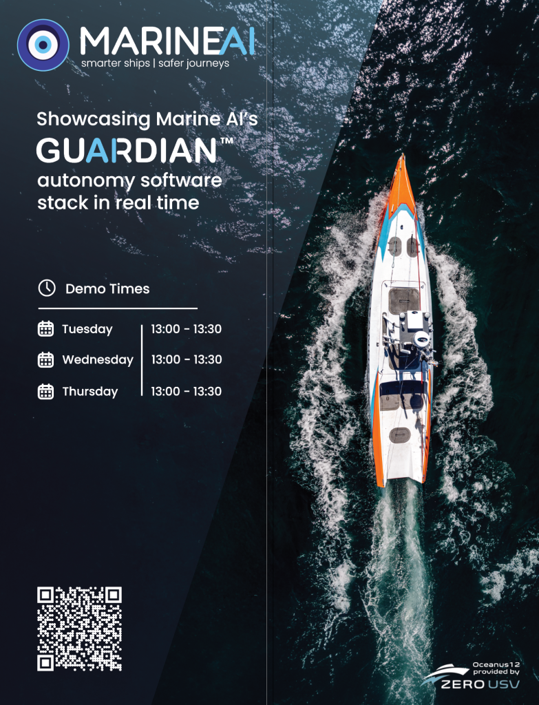
Its GuardianAI autonomy platform enables vessels to perceive their surroundings, interpret complex maritime environments and make safe navigation decisions in accordance with international maritime regulations. Rather than replacing human expertise, GuardianAI is designed to enhance operational capability by providing intelligent autonomy that can operate independently or alongside remote human supervision.
Marine AI’s technology has been successfully deployed across a diverse range of autonomous vessel projects, demonstrating how intelligent software, sensor integration and AI-driven decision-making can enable safe, reliable and scalable maritime autonomy.
Frequently Asked Questions
Can an autonomous vessel avoid collisions?
Yes. Modern autonomous vessels use radar, cameras, LiDAR, AIS and artificial intelligence to detect other vessels, assess collision risk and take appropriate action while complying with COLREGs.
Do autonomous surface vessels need GPS?
GPS is an important navigation input, but autonomous vessels typically combine GPS with inertial navigation systems, radar, vision sensors and other technologies to provide resilient positioning.
Can autonomous vessels operate in poor weather?
Many autonomous vessels are designed to operate in challenging conditions using radar, thermal imaging and redundant sensors. Operational limits depend on the vessel design and mission profile.
Are autonomous vessels completely unmanned?
Some are fully autonomous, while others operate under remote supervision from shore-based control centres. The level of human involvement varies according to operational and regulatory requirements.
What industries use autonomous surface vessels?
Autonomous surface vessels are widely used in defence, offshore energy, hydrographic surveying, environmental monitoring, maritime security, scientific research, infrastructure inspection and commercial marine operations.