Autonomous vessels do more than follow a predetermined line between two points. To operate effectively at sea, they need to understand where they are going, determine the most appropriate route and respond when conditions change.
This is where AI route planning for vessels becomes an important part of maritime autonomy.
An intelligent route-planning system can consider factors such as navigational constraints, vessel performance, weather, sea state, currents, traffic and mission priorities. It can then use this information to determine an appropriate route and, where necessary, recalculate that route during the voyage.
For an autonomous or uncrewed vessel, this capability forms part of a wider autonomy system. Route planning establishes where the vessel should go, while navigation, situational awareness and collision avoidance help it determine how to proceed safely.
What is AI route planning for vessels?
AI route planning is the use of software and intelligent decision-making systems to determine and optimise the route a vessel takes to reach a destination or complete a mission.
Traditional voyage planning generally produces a route before departure, represented by a series of waypoints. During the voyage, the bridge team monitors progress and makes changes where required.
An autonomous vessel must be capable of performing more of this decision-making digitally.
Rather than treating a route as an entirely fixed path, autonomous vessel route planning can use information about the vessel, its environment and its mission to continually assess whether the planned route remains appropriate.
Depending on the vessel and level of autonomy, this could involve relatively small adjustments or the generation of a substantially different route.
The objective is not simply to find the shortest route. The most appropriate voyage may instead balance safety, time, energy consumption, environmental conditions and operational objectives.
How does AI route planning work on an autonomous vessel?
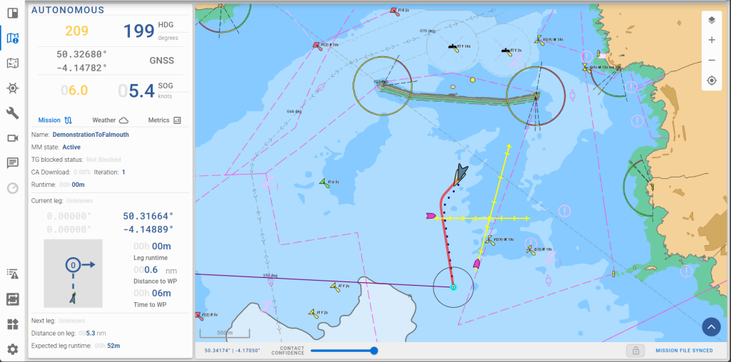
At its simplest, a route-planning system begins with a starting position and a destination or mission objective.
It then needs to understand the environment between those points.
This can involve digital charts and navigational data alongside information from other systems. Depending on the application, route planning may take account of:
- coastlines, shallow water and navigational hazards;
- restricted or controlled areas;
- weather forecasts and sea conditions;
- wind, tides and currents;
- expected vessel traffic;
- vessel speed, range and manoeuvring characteristics;
- fuel or battery consumption;
- mission objectives and operational constraints.
Software can evaluate different possible routes against these factors and determine which best meets the priorities assigned to the mission.
For some vessels, efficiency might be particularly important. For another operation, arrival time or maintaining a safe distance from particular hazards may take priority.
This is one reason autonomous navigation involves considerably more than simply connecting waypoints.
AI route planning versus conventional autopilot
It is important to distinguish intelligent route planning from a conventional marine autopilot.
An autopilot is primarily concerned with controlling a vessel so that it maintains a specified heading or follows a defined track. It does not necessarily decide whether that route remains the best one.
An autonomous navigation system can operate at a higher level.
It may assess the planned voyage, monitor changing conditions and determine whether the route should be modified.
A useful distinction is:
Autopilot controls the vessel along a route. AI route planning helps determine what that route should be.
This distinction becomes increasingly important as vessels operate for longer periods without personnel continuously making navigational decisions onboard.
Why does an autonomous vessel need dynamic route planning?
Conditions at sea rarely remain exactly as predicted when a voyage begins.
Weather changes. Traffic develops. Sea states alter. Operational priorities can change. A vessel may also encounter circumstances that make its original route less desirable.
Dynamic route planning allows the autonomy system to respond.
For example, an autonomous vessel may determine that continuing along its original route would take it into deteriorating weather. An alternative route could increase the distance travelled but provide safer conditions or reduce energy consumption.
A long-endurance autonomous vessel may need to make these assessments repeatedly during a mission.
The route therefore becomes something that can be continually evaluated rather than simply followed.
How weather and sea state affect autonomous route planning
Weather can have a substantial effect on the performance of a vessel, particularly smaller autonomous surface vessels.
Wind direction and strength can influence speed and energy consumption. Wave height and direction may affect vessel motion, while severe conditions could make a particular route undesirable.
An intelligent route-planning system can potentially incorporate forecast information when evaluating alternatives.
Instead of asking only:
What is the shortest route?
the system can ask:
What is the most appropriate route given the conditions the vessel is expected to encounter?
That distinction is important for vessels undertaking long-duration or offshore missions where energy management and endurance are critical.
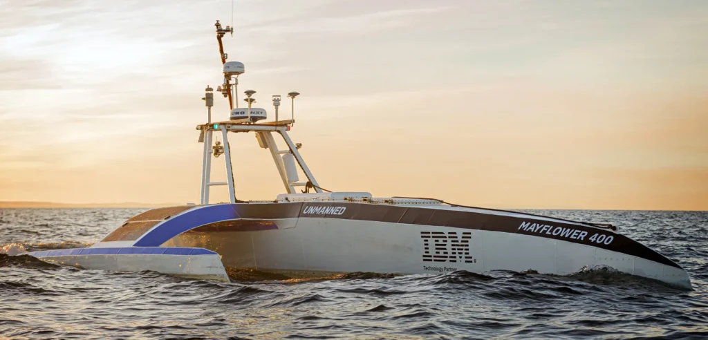
Using tides and currents to improve voyage efficiency
Water itself is moving, and an efficient autonomous navigation system needs to account for that.
Travelling against a strong current can increase the amount of energy required to maintain a particular speed. Conversely, taking advantage of favourable currents may improve efficiency.
Route optimisation can therefore consider both the geographical distance travelled and the predicted conditions along that route.
For battery-powered or other energy-constrained autonomous vessels, relatively small efficiency improvements can become significant over long missions.
An apparently longer route may sometimes be operationally preferable if environmental conditions allow the vessel to complete it more efficiently.
Route planning and mission management
Not every autonomous vessel is simply travelling from one port to another.
Autonomous surface vessels can undertake missions that require them to visit multiple locations, follow survey patterns, patrol defined areas or remain within a particular operating region.
Route planning therefore becomes closely connected with mission management software.
A survey vessel, for example, may be required to navigate a systematic pattern across a defined area. Another vessel might need to travel between a series of inspection locations.
The autonomy system needs to translate the overall mission into navigational actions while considering the constraints encountered during operation.
If circumstances change, the system may need to adjust how the mission is completed without losing sight of its overall objective.
What is the difference between route planning and collision avoidance?
Route planning and collision avoidance are related, but they solve different problems.
Route planning is strategic. It determines the path the vessel intends to take over a wider geographical area and period of time.
Collision avoidance is tactical. It deals with situations that develop as the vessel encounters other vessels or hazards.
Imagine an autonomous vessel travelling from A to B. Its route-planning system may have selected a route based on weather, currents and navigational constraints.
Several hours into the voyage, another vessel crosses its path.
The collision-avoidance system may determine that action is required and alter course or speed appropriately. Once the encounter has been safely resolved, the navigation system can determine how the vessel should continue towards its wider route and mission objectives.
The two capabilities therefore need to work together.
For a more detailed explanation of this tactical layer, see How Autonomous Vessels Avoid Collisions: AI, COLREGs and Collision Avoidance.
How situational awareness supports route planning
An autonomous system needs reliable information about its surroundings before it can make useful navigational decisions.
This is where sensor fusion and situational awareness become important.
Autonomous vessels may receive information from technologies such as radar, cameras, AIS, GNSS and other onboard sensors. Sensor fusion brings information from multiple sources together to create a more coherent understanding of the vessel’s environment.
That understanding can support both immediate collision-avoidance decisions and wider navigational planning.
There is therefore a hierarchy of connected capabilities:
Sensors → situational awareness → decision making → route/navigation planning → vessel control
Each layer contributes to the vessel’s ability to operate with reduced direct human intervention.
Can AI change an autonomous vessel’s route during a voyage?
Potentially, yes.
Dynamic replanning is one of the major differences between an intelligent autonomous navigation system and a vessel simply following a fixed set of instructions.
However, the extent to which a system can alter its route depends on the vessel, its operational parameters and the way its autonomy has been designed.
Some decisions may be handled automatically within predefined limits. More significant changes could require human approval or intervention.
Autonomy should therefore not necessarily be viewed as an all-or-nothing concept.
Different operations can employ different levels of human supervision depending on risk, regulation and mission requirements.
The role of Remote Operation Centres
Even highly autonomous vessels can remain connected to people ashore.
A Remote Operation Centre (ROC) can allow operators to monitor vessel status, mission progress and navigational decisions from shore.
The autonomy system can handle routine decisions while escalating circumstances that require human attention.
This approach can be particularly valuable when one operator is supervising autonomous vessels over long-duration missions. Rather than continuously steering each vessel, personnel can oversee operations at a higher level and intervene when necessary.
AI route planning consequently complements remote operation rather than necessarily replacing the human operator.
Route planning and energy efficiency
Optimising a voyage isn’t solely about reaching the destination quickly.
For autonomous vessels expected to operate for extended periods, energy management can become an important part of route selection.
The most energy-efficient route may vary according to:
- speed;
- wind;
- waves;
- currents;
- vessel characteristics;
- propulsion system;
- mission duration.
An autonomy system can potentially evaluate these factors together rather than optimising each one independently.
This becomes particularly significant for vessels designed for persistent offshore operation, where extending endurance may be more valuable than minimising journey time.
AI route planning for offshore and long-endurance missions
The benefits of intelligent route planning become especially apparent as missions grow longer and more complex.
An autonomous vessel operating for days or weeks may encounter conditions that could not have been predicted precisely when the mission began.
The ability to reassess a route gives the vessel greater operational flexibility.
For example, an offshore autonomous vessel could adjust its voyage to respond to changing weather while continuing to work towards its mission objectives. A survey vessel could alter the order in which areas are covered. Another vessel could modify speed or routing to conserve energy.
The common principle is that the vessel can make informed navigational decisions as circumstances develop.
Where does AI fit into autonomous navigation?
Artificial intelligence is best understood as one component within a wider autonomous vessel architecture.
The system needs to combine perception, navigation, decision making and control.
Information about the surrounding environment can be interpreted alongside charts, mission data and other sources. Navigation software can then determine possible actions, while control systems translate decisions into changes in heading, speed or propulsion.
This interconnected approach enables a vessel to move beyond simply executing predetermined instructions.
It can respond intelligently to what is actually happening around it.
The future of intelligent voyage optimisation
As maritime autonomy develops, route planning is likely to become increasingly integrated with other vessel systems.
Rather than planning navigation, collision avoidance, energy use and mission execution as separate activities, autonomous platforms can consider them as parts of the same operational problem.
A route might therefore be evaluated simultaneously according to safety, efficiency, environmental conditions, vessel performance and mission priorities.
For autonomous vessels, the ultimate goal is not simply to navigate without a crew continuously controlling the vessel.
It is to make appropriate navigational decisions throughout the voyage.
AI route planning is an important part of achieving that goal.
Frequently Asked Questions
What is AI route planning for vessels?
AI route planning uses intelligent software to determine and optimise the route a vessel should take. It can consider factors such as navigational constraints, weather, sea conditions, currents, vessel performance and mission objectives rather than relying solely on a fixed sequence of waypoints.
How do autonomous vessels plan their routes?
Autonomous vessels can combine digital navigational information, mission requirements and environmental data to evaluate possible routes. The autonomy system can then select a route and potentially modify it as conditions change.
Can an autonomous vessel change its route while at sea?
Yes, depending on the vessel’s autonomy system and operational rules. Dynamic route planning can allow a vessel to recalculate its route in response to factors such as weather, traffic, navigational constraints or changing mission requirements.
What is the difference between autonomous navigation and collision avoidance?
Autonomous navigation manages the vessel’s wider movement and route towards its destination or mission objectives. Collision avoidance deals more specifically with detecting potential conflicts and determining appropriate action to avoid other vessels or hazards.
Is AI route planning the same as autopilot?
No. An autopilot generally controls the vessel to maintain a heading or follow an established track. AI route planning operates at a higher level, helping determine and potentially optimise the route the vessel should follow.
How can AI route planning improve vessel efficiency?
Route-planning software can consider factors such as currents, wind, waves, speed and vessel performance. This can help identify routes that balance journey time with energy consumption and operational requirements.
Does AI route planning replace human operators?
Not necessarily. Autonomous route planning can handle many navigational decisions while people supervise operations remotely. Depending on the system and mission, significant decisions can also be escalated to a human operator in a Remote Operation Centre.
How does sensor fusion support autonomous route planning?
Sensor fusion combines information from multiple onboard systems to create a more complete picture of the vessel’s surroundings. This situational awareness supports navigation, collision avoidance and other autonomous decision-making processes.